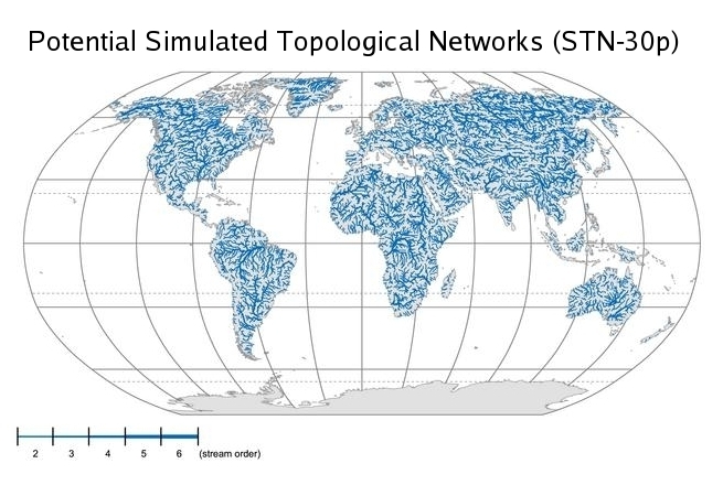
Simulated Topological Networks are used to represent the linkage of continental land mass and river networks in the Global Hydrologic Archive and Analysis System (GHAAS). STN networks are generated at various resolutions. The 30-minute STN for the world (shown above) is suitable for monthly flow simulations, such as used in the GHAAS Water Transport Model (WTM). Other uses of the STN include the derivation of basin-wide or subbasin characteristics such as stream order, mainstem length and catchment area.
Simulated Topological Networks (STN-30p) Version 5.12
STN-30p Data Structures (version 5.12)