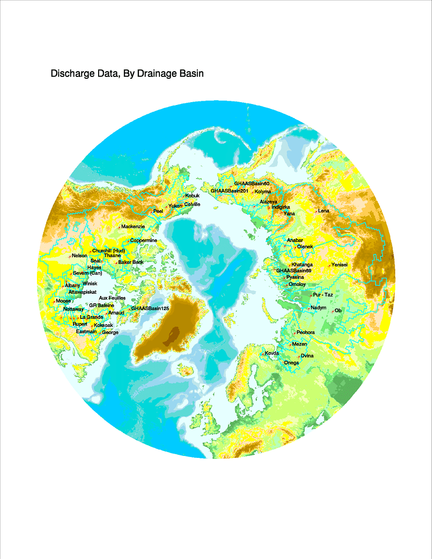
The Major Basins within the Pan-Arctic Drainage System

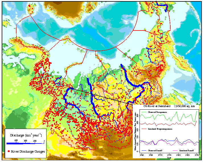
Discharge Graphic

The Russian pan-Arctic watershed, partitioned according to drainage
regions for each coastal Sea. River discharge gauges (red dots) and a
river discharge field (blue lines) calculated from the observed record
are also included. The inset shows a preliminary simulation run of the
Permafrost Water Balance Model for the Ob River basin covering the
period 1960-1990.
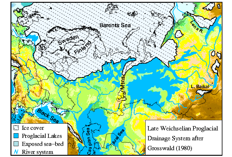
Paleo graphic

The Late Weichselian Progracial Drainage System after Grosswald (1980).
An example of the configuration of the Eurasian hydrologic system during
one interpretation of the glacial maxima.
Return to the
Pan-Arctic,
Global Hydrology Group,
or the
Complex Systems
Home Page.
This page written by Richard Lammers


